2015-14
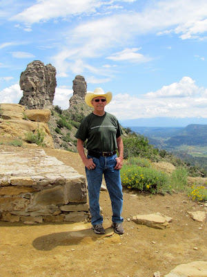 |
| At Chimney Rock National Monument |
Durango, continued:
Dolores Colorado
Cortez Colorado
Campground: McPhee Reservoir/Lake, Juniper campground. $16 senior rate, regular $22. 50 amp Electric. Water available but only one water station with hookup for a waterhose. Dump station currently closed. Campsites among Juniper and Pinion trees. No water views. 110 over-the-air Tv stations, yes really! That’s a ton of TV stations including a number of music stations, some playing live music others play videos or still shots. Blue Highway being a new favorite. Fair Verizon service.
A few notes on Durango:
The downtown area is covered with parking meters. A least now they also accept credit cards but to me it’s still a pain in the behind to have to pay to park in a town and then they expect you to shop and dine as well.
There are no free parking lots and those that are available clearly state you will be fined and your vehicle towed.
Most of the restaurants are locally owned and operated with only a handful of commercial/national chain restaurants in town. Including a few brewing companies and one distiller.
The smell of patchouli wafts in the air from a number of shops on main street. I’ve seen a couple of “smoke shops” but haven’t ventured in to see if they sell marijuana which is legal in Colorado. Along the walking path into town and at the fairgrounds, the smell of pine trees is prevalent. A most wonderful smell.
 |
| Durango Library along the walking/biking trail |
 |
| scene along the walking/biking trail into Durango |
Median household income: $51,800
Median house or condo: $355,000 (above average for Colorado)
Average rental: $1,100
A day trip
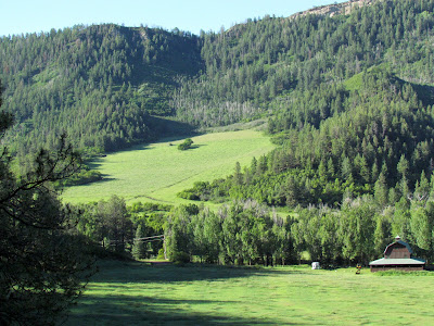
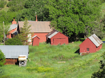
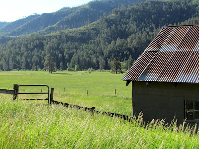
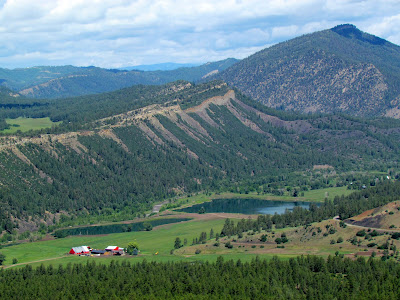
I headed east on county road 240 up over the mountains outside of town. Noticed there are some pretty nice homes and high end subdivisions tucked up in the forests overlooking the mountain ranges and Durango below. I continued eastward as the road wound through some really pretty alpine meadows with Ponderosa Pines climbing up the sides of the ridges and mountains. I’m heading towards Vallecito Reservoir Lake. In 2002 they had a 70,000 acre forest fire that destroyed much of the surrounding forests. But today the hillsides are dotted with burned out tree trucks and green with grasses and small tree shoots are coming up. Letting nature do it’s thing rather than man reforesting by planting saplings.
 |
| along County Road 240 |
 |
| along County Road 240 |
 |
| along County Road 240 |
 |
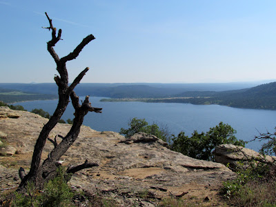
| Vallecito Reservoir Lake |
 |
| Vallecito Reservoir Lake |
On the east side of the lake a dirt road leads to a number of semi-developed campgrounds that boarder the lake. The west side of the lake which is a paved road has a few small communities including four commercial campgrounds and cabins for rent. The couple of restaurants are only open on weekends by the looks of it. A wood carver has taken logs and created a number of carvings dedicated to the firefighters and can be found along the western side of the reservoir.
Made for a really nice day trip.
On my last day in the area, I drove over to
Chimney Rock National Monument. It’s halfway between Durango and Pagosa Springs. I’ve been to this site before, but once again, it’s a great day trip out into the country, though I might add hwy 160 has a lot of road construction and repaving going on. Giving me more time to enjoy the scenery as I had to slow down for the one way traffic periodically. Hwy 160 has electronic signs that warn you if wildlife has been detected in the area…. I.e. slow down and be on the lookout so you don’t run into any elk, deer, bear, etc. Wonder if it helps save the wildlife?
Chimney Rock is considered the furthest outlying posts with a Great House in the Chacoan style, indicating it was an outpost for Chaco Canyon. Thousands of Native Indians had banded together during the Chaco period and were in a sense a very large community or even country encompassing much of the 4 corners region. A student was able to prove they were able to communicate 90 miles way with Chaco Canyon.
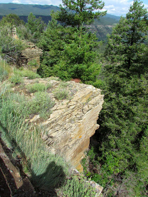 |
| from high up on the Mesa |
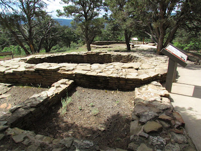 |
| pit houses |
 |
| surrounding scenery, Chimney Rock |
 |
| and we hike up, higher and higher |
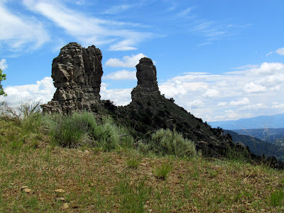 |
| Chimney Rock, used for sky observations, sun and moon |
 |
| part of the Chacoan style great house constructed on top of the Mesa |
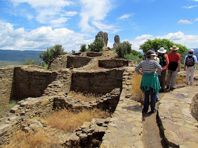 |
| The great house was aligned with Chimney Rock in the distance |
Distance Traveled: 58 miles
Ok, so it’s a short drive of about an hour and a half, but still you know how I love being on the road. Had to stop in the little Town of Dolores Co. to get better directions to my campsite at McPhee reservoir and I had lunch in the little town. The people are so friendly here. I’m staying in the area for 7 days, but may extend just because the place feels just right.
 |
| McPhee Reservoir Lake |
 |
| along the Can Do Trail |
 |
| actually one of my favorite shots this week |
I’ve settled in at the McPhee campground. The reservoir was created in the early 1980’s and the Anasazi Heritage Center was created to store and interpret the 1.5 million artifacts that were collected in the largest archeological dig in North America. Those artifacts had to be found, dug up and recovered before the new McPhee reservoir began to fill up. Covering both Native American historical sites as well as the lumber town of McPhee.
Anasazi Heritage Center
I toured the
Anasazi Heritage Center, which has world class museum exhibits from all those collected items from the McPhee project but also from the Canyon of the Ancients National Monument where over 6,000 Indian sites have been identified to date. Canyon of the Ancients was declared a National Monument by President Bill Clinton in 1980 and has the highest concentration of Indian sites in America.
 |
| A small part of over 4.5 million collection |
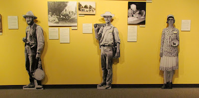 |
| the first explores and archaeologists |
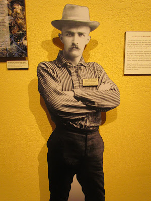 |
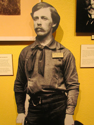
| Gustaf Nordenskiold |
 |
| hows that for sneaking in my Swedish heritage.... |
 |
| one of the first young photographers |
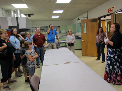
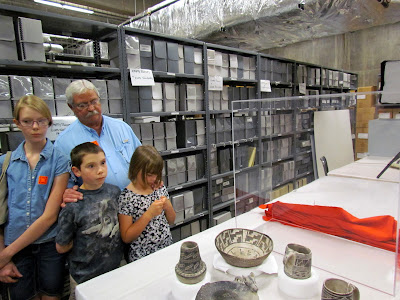
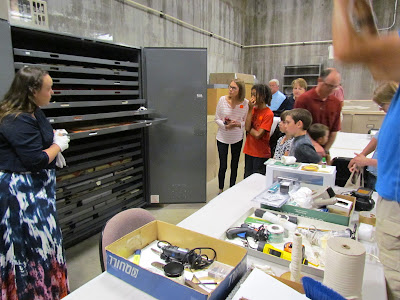
The second part of my tour would start in the afternoon and would take me and a select group down into the basements of the Heritage Center for a behind the scenes tour of where over 4 million artifacts are examined, cataloged, stored and entered onto a database that one day will be accessible to the public. Seeing many rare and unusual Native American artifacts close up and having them explained in a more detailed manner really brings the history of this region to life.
Note: the behind the scenes tour is only given on Thursdays at 2 pm and the number of people is restricted.
 |
| what an exciting behind the scenes tour |
 |
| being able to get up close to some special artifacts |
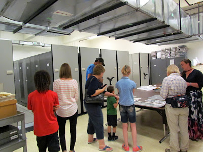 |
| we are two stores below ground |
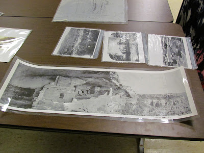 |
| thousands of photographs from the first expeditions |
 |
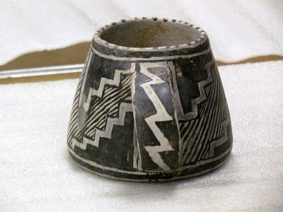
| currently 4.5 artifacts are stored here |
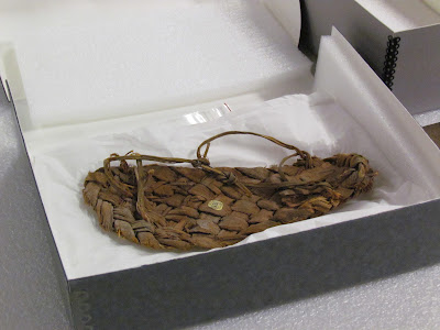 |
| a very rare yucca plant sandal still intact |
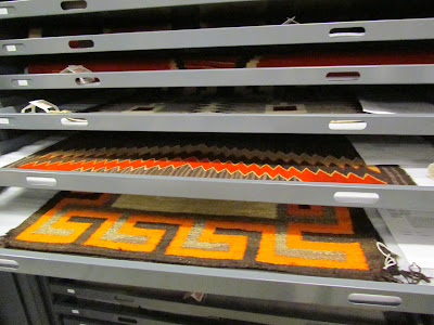 |
| items from the Wetheral Trading post |
 |
what a grand opportunity to see the behind the scenes storage
and research areas at the heritage center |
I have so much more to explore in the area over the next couple of days but as always with my travels, I give myself a day off to enjoy the campground, go for a walk, today's walk was the “Can Do Trail” and then into Dolores for lunch and picking up my mail.
Wishing you all the very best of adventures,
From the back-roads of America, happy trails to you.
more photos on
PICASA


